
For thousands of years, people used observational systems and cultural wisdom to understand nature. Ancient Babylonian priests watched the stars, while Chinese scholars noted cloud patterns. These early pioneers helped start modern weather science.
• Astronomical patterns guiding agricultural cycles in Mesopotamia
• Cloud classification systems developed during China’s Han dynasty
• Greek theories linking weather to elemental balances
The move from superstitious interpretations to evidence-based analysis was key in pre-industrial meteorology. Scholars in the Mediterranean, like Aristotle, studied wind patterns. They mixed philosophy with observation. At the same time, farmers used folk wisdom, watching animal and plant responses.
This mix of cultural knowledge and new science led to advanced prediction methods long before digital tools. The wisdom of these old practices is part of today’s weather understanding.
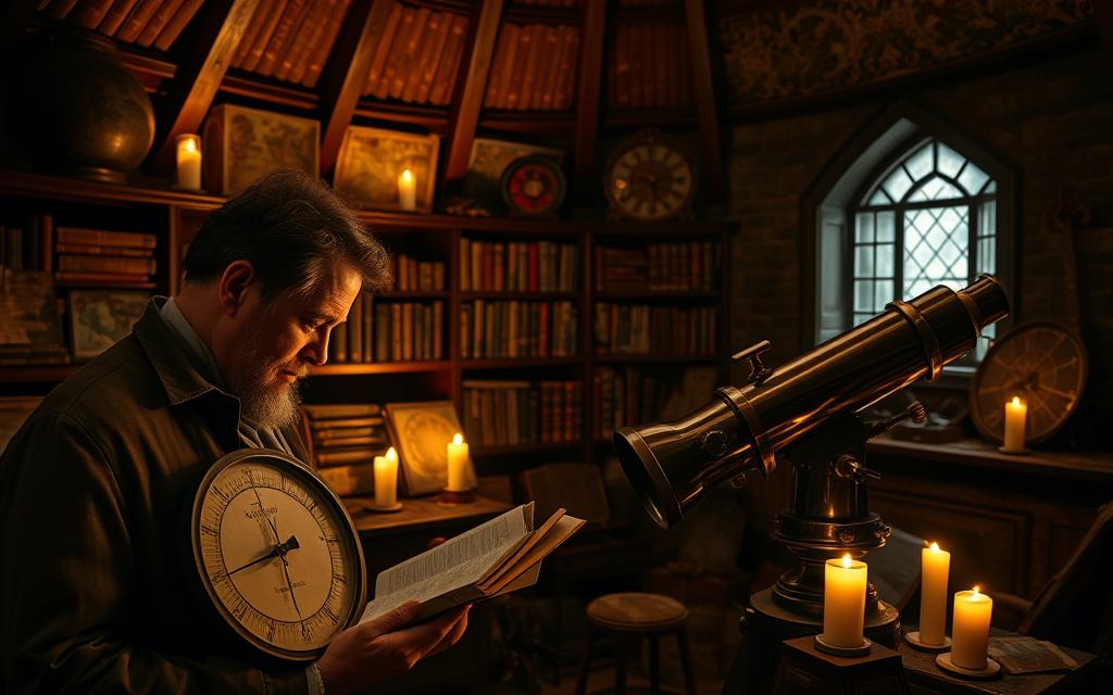
How Was Weather Predicted Before Modern Technology: Ancient Observational Techniques
Long before we had satellites or thermometers, ancient people found clever ways to understand the weather. They mixed astronomy, farming, and philosophy to create early weather science.
Babylonian Cloud Patterns and Wind Observations
In Mesopotamia, scholars started tracking the weather around 650 BCE. They used cuneiform weather records on clay tablets to note cloud types and wind directions with great detail.
Use of cuneiform tablets for recording weather patterns
These ancient weather watchers made detailed logs linking cloud types to rain. A tablet from Nineveh says: “When the sky wears a fleeced mantle, the canals shall brim within seven days.”
Astrological correlations in weather prediction
The Babylonians were the first to link planets to weather. They thought Jupiter’s position could predict floods and Venus’s brightness could signal droughts. These ideas are studied today in historical climatology.
Related Posts:
- What Is Modern Agriculture Technology Innovations in Farming

- Is Information Technology a Good Course Career…

- How to Get Into Health Information Technology A…

- What Is a Technology Application Software and Tools…

- Main Factors in Technological Progress Drivers of Innovation

- What Does a Director of Technology Do Leadership in Tech

Chinese Meteorological Innovations
China’s Zhou Dynasty made big strides in weather science with new tools and seasonal plans. They focused on helping farmers, mixing government with nature watching.
Development of rain gauges in 4th century BCE
The first Chinese rain measurement system was made with bronze vessels. Officials used this data to adjust taxes and grain storage, showing early use of data in governance.
Seasonal division systems and agricultural planning
By 300 BCE, China had a 24 solar terms calendar for farming. The “Grain Rain” and “Great Heat” festivals helped farmers know the best times to plant and harvest. This showed a deep understanding of nature’s cycles.
Greek Philosophical Contributions
In the East, people focused on practical weather use, while Greeks developed theories that shaped European weather science for ages. Their Aristotelian meteorology mixed observation with deep thinking.
Aristotle’s Meteorologica treatise
Aristotle’s work said weather came from earth’s vapours and the sky. His idea that rain was “air condensing into water” was wrong, but it started systematic weather study.
Hippocrates’ air-quality observations
The Hippocratic Corpus linked weather to health, telling doctors to watch wind when diagnosing fevers. This was the first time in Western medicine that weather was linked to health.
Medieval Weather Lore and Animal Behaviour
Before we had satellites, medieval Europeans used rhymes and animal signs to guess the weather. They mixed old wisdom with early science. This mix is why we’re interested in their weather forecasts today.
Rhymes, Saints, and Sky Secrets
Weather rhymes were common in medieval times. Some of these sayings are with us today. For example, “Red sky at night, shepherd’s delight” comes from the Bible. It’s true because red sunsets mean dry air is coming.

People believed rain on Saint Swithin’s Day (15 July) meant 40 days of rain. This might have come from the medieval warm period when July was more stable.
Nature’s Living Barometers
Farmers used animal signs to predict the weather:
- Swallows flying low meant storms were coming (air pressure changes affect insects)
- Cows under trees meant rain was near
- Active ants meant it would be dry
Barnyard Meteorology
Shepherds checked sheep’s wool to guess humidity. Chickens’ dust baths told them if it would be dry. These signs were not always right, but they often matched what we can measure today.
Church-Driven Climate Records
Monasteries kept weather diaries, thanks to monastic meteorology. The Winchester Chronicle (1100-1204) is England’s oldest weather record. It notes things like:
| Year | Event | Agricultural Impact |
|---|---|---|
| 1172 | Severe frost in May | Failed apple harvest |
| 1190 | Prolonged drought | Wheat prices tripled |
Calendar vs Climate
Church calendars told farmers when to plant and harvest. But the weather didn’t always agree. This led some monasteries to create flexible farming plans. These were early steps towards modern weather-based farming.
Indigenous Knowledge and Traditional Forecasting
Long before we had satellites and radars, native cultures could predict the weather. They knew their ecosystems very well. They mixed astronomy, botany, and animal behaviour to forecast the weather. These old ways are now helping us understand the climate today.
Native American Seasonal Tracking
Tribes across America had their own weather strategies. They were very good at predicting the weather in their local areas.
Navajo Star Navigation and Cloud Formations
The Diné people used the stars to predict the weather. They knew that certain star movements meant it was time for a new season. They also watched the clouds to see when storms were coming. An elder once said:
“When the Pleiades dip below the horizon, the earth remembers to breathe winter.”
Iroquois Three-Sisters Planting System
This sustainable agricultural practice was all about timing. They planted corn, beans, and squash when the soil was just right. This way, their crops grew well without getting frost.
Polynesian Wave Pattern Navigation
Pacific voyagers read the ocean like a book:
- Swell refraction patterns warned of storms 800km distant
- Bird flight paths revealed approaching weather fronts
- Cloud colouration indicated wind shifts across latitudes
Bird Migration Patterns Across Pacific Routes
When certain seabirds disappeared, sailors knew it was time to change course. This zoological forecasting helped them cross vast oceans safely.
African Tribal Weather Wisdom
Sub-Saharan communities could predict droughts:
| Indicator | Tribe | Weather Signal |
|---|---|---|
| Baobab flowering | Shona | 24-month drought forecast |
| Termite mound activity | San | Rainfall timing ±3 days |
San People’s Insect Behaviour Observations
The San people could predict the rains with 90% accuracy. They watched how beetles moved and how ants grew. This native forecasting system is now on UNESCO’s list of Intangible Cultural Heritage.
Scientific Advancements in the 18th and 19th Centuries
The 18th and 19th centuries were a big change for weather prediction. Superstition was replaced by careful observation. This time saw the start of tools and networks that made meteorology a data-driven science. This laid the foundation for today’s weather forecasts. For more details, check out this timeline of meteorological progress.
Invention of Basic Meteorological Instruments
Important devices changed how we measure the atmosphere. Evangelista Torricelli’s 1643 mercury barometer was the first reliable tool for tracking air pressure. It showed how weather might change.
Daniel Fahrenheit’s thermometer (1714) brought standardised temperature scales. It replaced old ways of saying “unseasonably cold” with exact numbers.

This mercury-filled glass tube showed air pressure drops before storms. Sailors used portable versions, making sea travel safer.
Fahrenheit’s improved thermometer design
His 1709 alcohol thermometer evolved into the mercury model we know today. It allowed for comparing weather patterns worldwide.
Global Weather Data Networks
The 1840s saw a big change. Joseph Henry’s Smithsonian weather network linked 500 observers via telegraph. This created the first real-time weather maps.
By 1855, transatlantic cables let European and American meteorologists share warnings quickly. This was a huge improvement over the old days.
Smithsonian Institution’s observer network
Volunteers recorded conditions at 8am daily with the same instruments. Henry said, “We’re stitching a quilt of data to cover the globe.”
Transatlantic telegraph coordination from 1850s
In 1856, a hurricane hit New York. London meteorologists tracked it using cable reports. This was the first time they worked together internationally.
Early Weather Mapping Techniques
Seeing atmospheric data led to predictive meteorology. Royal Navy officer Robert FitzRoy started using synoptic charts in the 1860s. He combined wind, pressure, and temperature data to predict storms.
FitzRoy’s storm warning systems
His “forecasting drums” – rotating cylinders with coastal warnings – cut UK fishing deaths by 60% in a decade.
First isobar maps in newspaper publications
The Times published the first public weather map in 1875. It used curved lines to show equal pressure points. This helped people understand why their picnics got rained out!
Conclusion
For thousands of years, humans have tried to predict the weather. They started by watching the sky and noticing patterns on the ground. The Babylonians looked at clouds, while the Chinese used rain gauges to track the monsoons.
Greek philosophers then came along and started to understand the weather in a scientific way. They used natural philosophy to explain how the atmosphere works. This was a big step away from myths.
In medieval Europe, people used weather rhymes to guess the weather. And in the Pacific, Indigenous navigators used waves to guide them. These old ways of predicting the weather were later mixed with new science.
The Enlightenment brought big changes with the invention of barometers and thermometers. These tools helped turn guessing into real data. By the 1800s, telegraphs allowed for the first real-time tracking of storms.
Today, we use satellites and supercomputers to study the weather. These tools help us understand what our ancestors noticed in the sky. Groups like NOAA and the UK Met Office use old knowledge and new tech together.
They work with Māori star navigators and Inuit snow experts. This mix of old and new is key as the climate changes. It helps us prepare for extreme weather by combining old wisdom with new tech.
Now, we use Doppler radar and ancient methods to predict weather. Researchers look at Mayan calendars and Tibetan glacier stories to improve our climate forecasts. This shows that old knowledge is just as important today.
From ancient tablets to modern forecasts, our understanding of the weather has grown. Each new discovery builds on what came before. It shows that weather science is a mix of culture and science.
FAQ
How did ancient Babylonians use astrology to predict weather?
The Babylonians mixed star watching with weather tracking, as seen in clay tablets from 650 BCE. They looked at clouds, wind, and stars, thinking stars affected the weather. Their work was one of the first ways to predict the weather.
What practical meteorological tools did ancient China develop?
The Chinese made bronze rain gauges in the Qin Dynasty (221-206 BCE) to track rain for farming. They also made detailed lunar calendars that linked weather with farming, showing a practical way to understand the climate.
Why were Aristotle’s weather theories influential despite inaccuracies?
Aristotle’s Meteorologica (350 BCE) had wrong ideas about rain, like it coming from earth. But, his ideas about weather types were new and lasted for nearly two thousand years, showing early attempts at understanding weather.
Do medieval weather rhymes like “red sky at night” hold scientific merit?
Some sayings, like a red sunset meaning good weather, are based on real observations. But, many mix old wisdom with Christian beliefs, without proof.
How did monastic chronicles contribute to weather history?
Medieval monasteries recorded big weather events like the Great Frost of 1684. These records are now key for understanding past climates, like the Little Ice Age.
What environmental indicators did Navajo celestial navigators use?
Navajo Hózhǫ́ǫ́gi experts followed the Pleiades, watched clouds, and checked pine resin to predict the seasons and storms.
How did Polynesian navigators forecast storms at sea?
A: Pwo navigators looked at waves, clouds, and birds to spot storms. They knew how to change course before big storms hit during long sea trips.
What breakthrough did Joseph Henry’s Smithsonian network achieve?
As Smithsonian Secretary (1846-1878), Henry set up the first national weather network using telegraphy. His system allowed for the first weather maps, changing how we track storms.
How did FitzRoy’s storm glass contribute to marine safety?
FitzRoy’s 1860 system used pressure and a special glass to warn of storms. His forecasts in The Times helped save ships, starting modern weather services.
Why do modern climatologists study traditional ecological knowledge?
Old ways like the San people’s termite mound watching or Māori maramataka calendars give long-term climate data. They show how to adapt to climate change, important today.